Vaslui County - Map of local communities
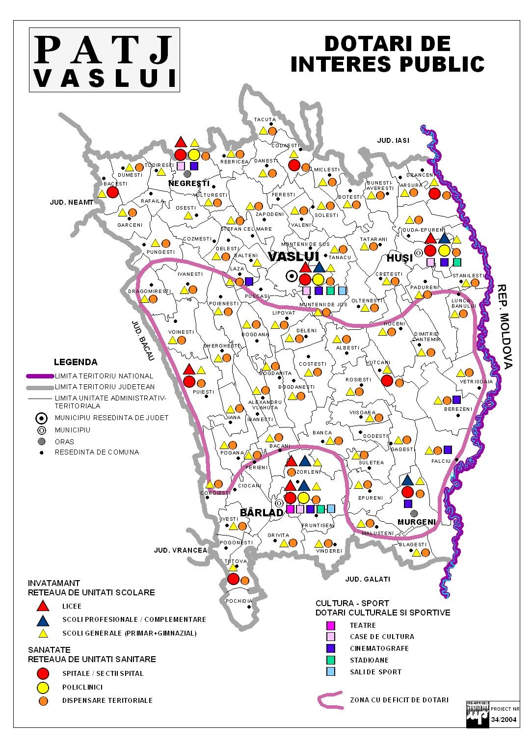
They are represented: schools, hospitals, cultural institutions (theatres, cultural centers, cinemas), gyms and stadiums
They are represented: schools, hospitals, cultural institutions (theatres, cultural centers, cinemas), gyms and stadiums

terrains, soils, erosions and pollution are depicted

They are figurative; polluted waters, major environmental problems, natural habitats, nature reserves, natural monuments

The map mentions: accommodation units, hunting and fishing grounds, tourist heritage and tourist potential, the main cultural objectives in the county, spa resources, tourist areas, museums and objectives... Read More »Vaslui County – Tourist map (tourist heritage)

Offline map of Vaslui county with localities, population, demographic evolution and demographic trend for all localities in the county

. Activities in the processing industry. For the economic summary, see the Vaslui county page on the Comersant.ro website

Map of migration and migratory potential in each of the localities of Vaslui county Link to the large map

Living conditions and quality of housing in Vaslui county. Dysfunctions and areas with low housing potential are mentioned

Economic map of the primary sector (economic production activities)
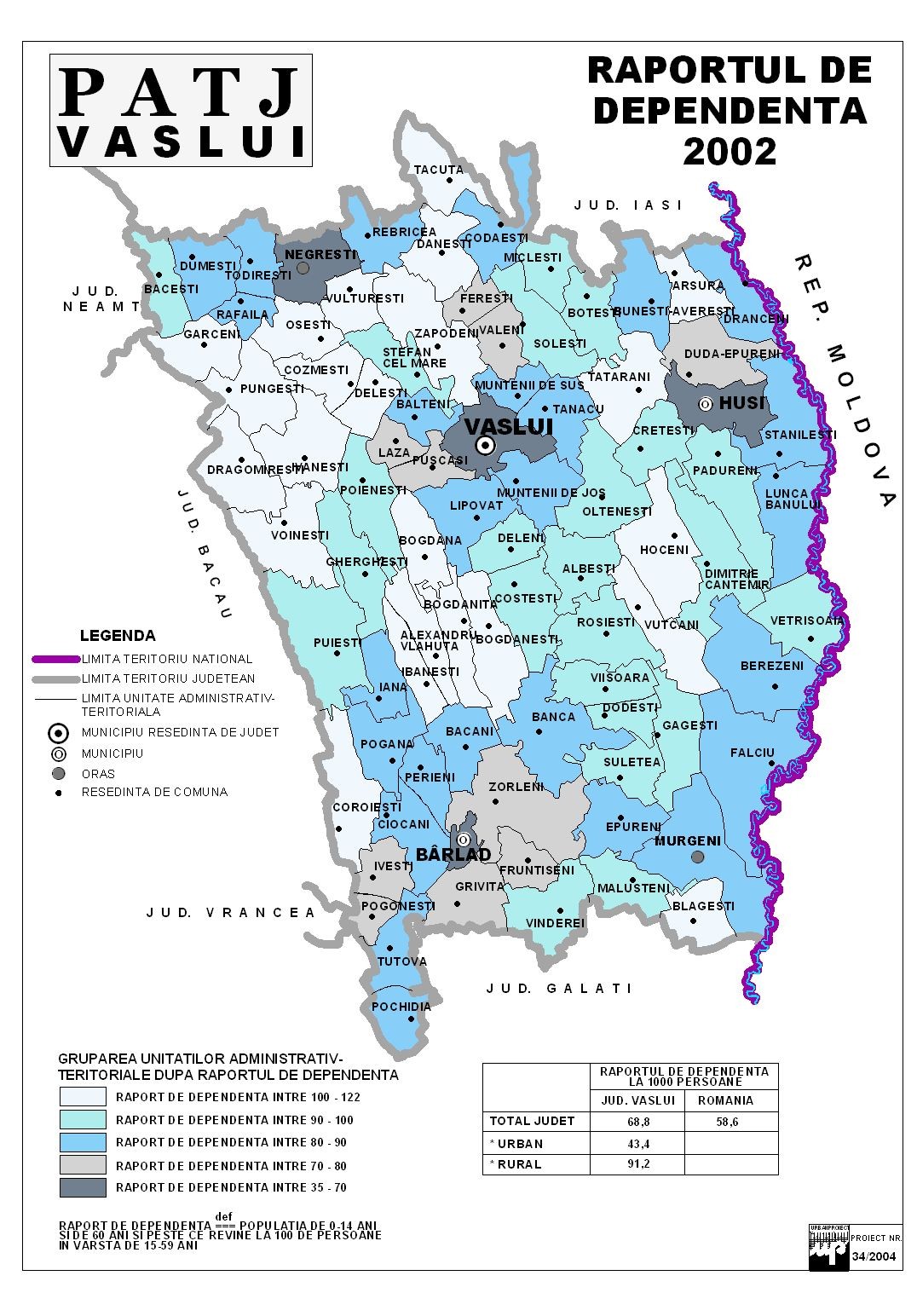
The demographic and economic problems of Vaslui county (the dependency ratio of the assisted population compared to the economically active population)

The monuments of the county, the list of historical monuments, memorial houses, archaeological sites, the limits of the old administrative divisions (eg Tutova county), medieval commercial roads are illustrated.
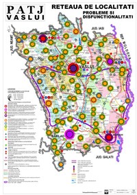
The map monitors mono-industrial areas, areas with migratory potential, the deficiency of social and commercial infrastructure, health risks. The map was drawn up at the request of the Vaslui County Council. Read More »Vaslui County - Map of economic and social dysfunctions
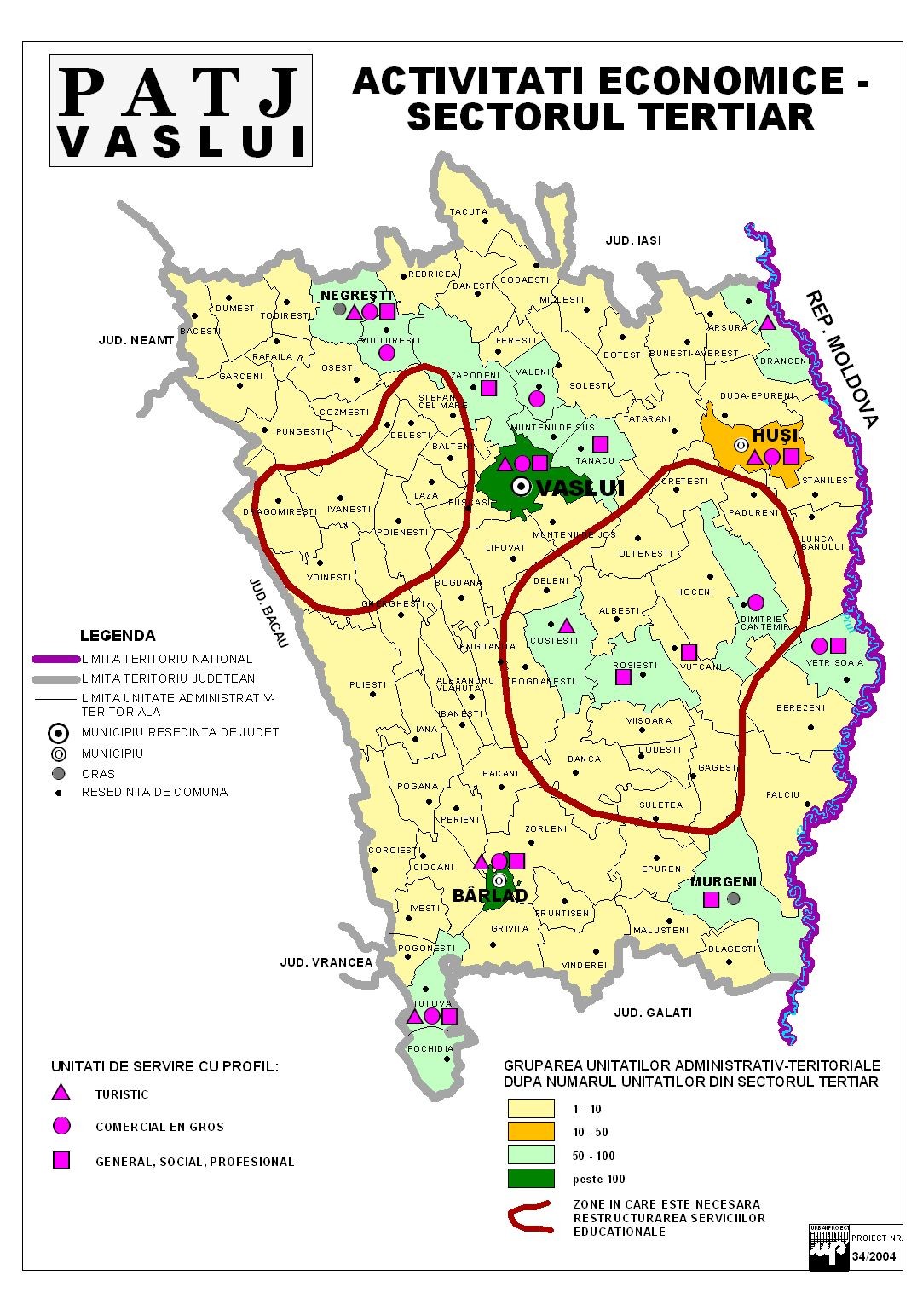
Economic map - tertiary sector - of Vaslui County: wholesale shopping centers, tourism services, other services (social, general, professional) are shown.

The industrial branches, services, agricultural lands, their specificity and quality are illustrated. LINK: Original map (large size)