Southern Transylvania – macro-development economic map
Economy: Transylvania (Romania) macroregional map Cluj Napoca – Sibiu, Oradea, Targu Mures, Brasov, Miercurea Ciuc. Regional relations, infrastructure and the road network
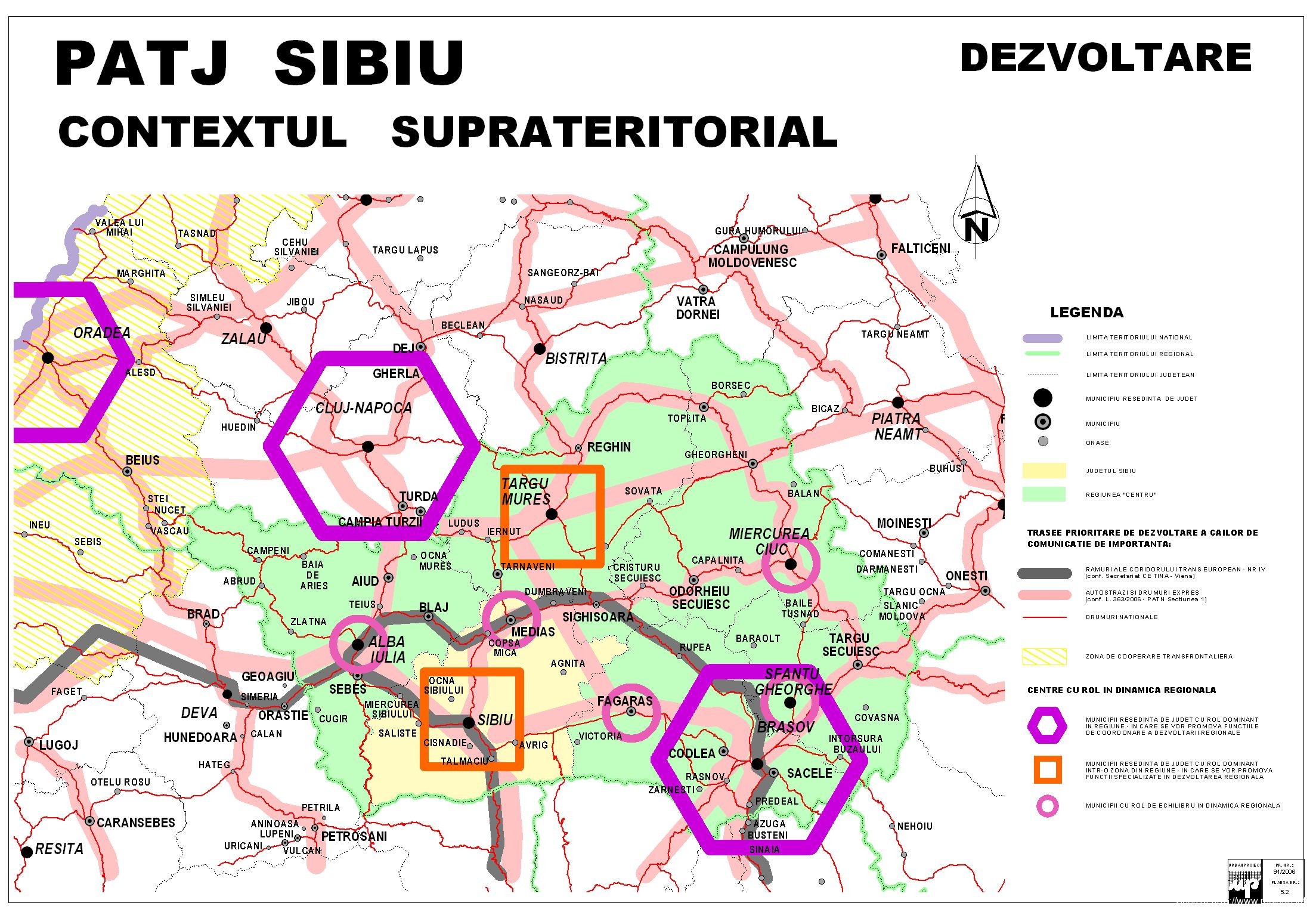
Economy: Transylvania (Romania) macroregional map Cluj Napoca – Sibiu, Oradea, Targu Mures, Brasov, Miercurea Ciuc. Regional relations, infrastructure and the road network

Map of the main touristic institutions and sights in the Municipality of Oradea Map in flash format with the streets, touristic sights and institutions in Oradea, Bihor county Mentioned sights:... Read More »Oradea - interactive map

Interactive flash format. To activate, click on the map or use the attached link Link: http://www.cjbihor.ro/harta_bihor.php Mentions: the cities and communes of Bihor county. Special mentions: Oradea,... Read More »Administrative map of Bihor county

Official map published by CJ Bihor with the wooden churches - monuments and tourist attractions in Bihor county

Abrud, located in the mountain region of the Western Carpathians (Western Mountains). See pictures from Abrud and the area. Adjacent towns and roads are shown on the map... Read More »Abrud (Apuseni) Tourist and road map

The northern area of Bihor (Between Oradea and Satu Mare). The main cities are Carei, Margita, Alesd and Valea lui Mihai (customs point with Hungary), as well as... Read More »Bihor Area (Romanian Maps)

RO: Tourist map of the APuseni mountains, with the ski areas and the main tourist towns. The Apuseni Mountains are located in Transylvania, and the main access roads... Read More »Tourist Map Apuseni Mountains (Romania)